

This is another bucket list item, Death Valley National Park, to mark off the list. I didn’t realize that Death Valley was an actual national park. I thought it was a place that you just drove through on your way to someplace else. Well yes, it is a national park and it isn’t a place you drive through to get somewhere.
 |
| Back into Nevada from California. Note the animal crossing grate in the road at the border |
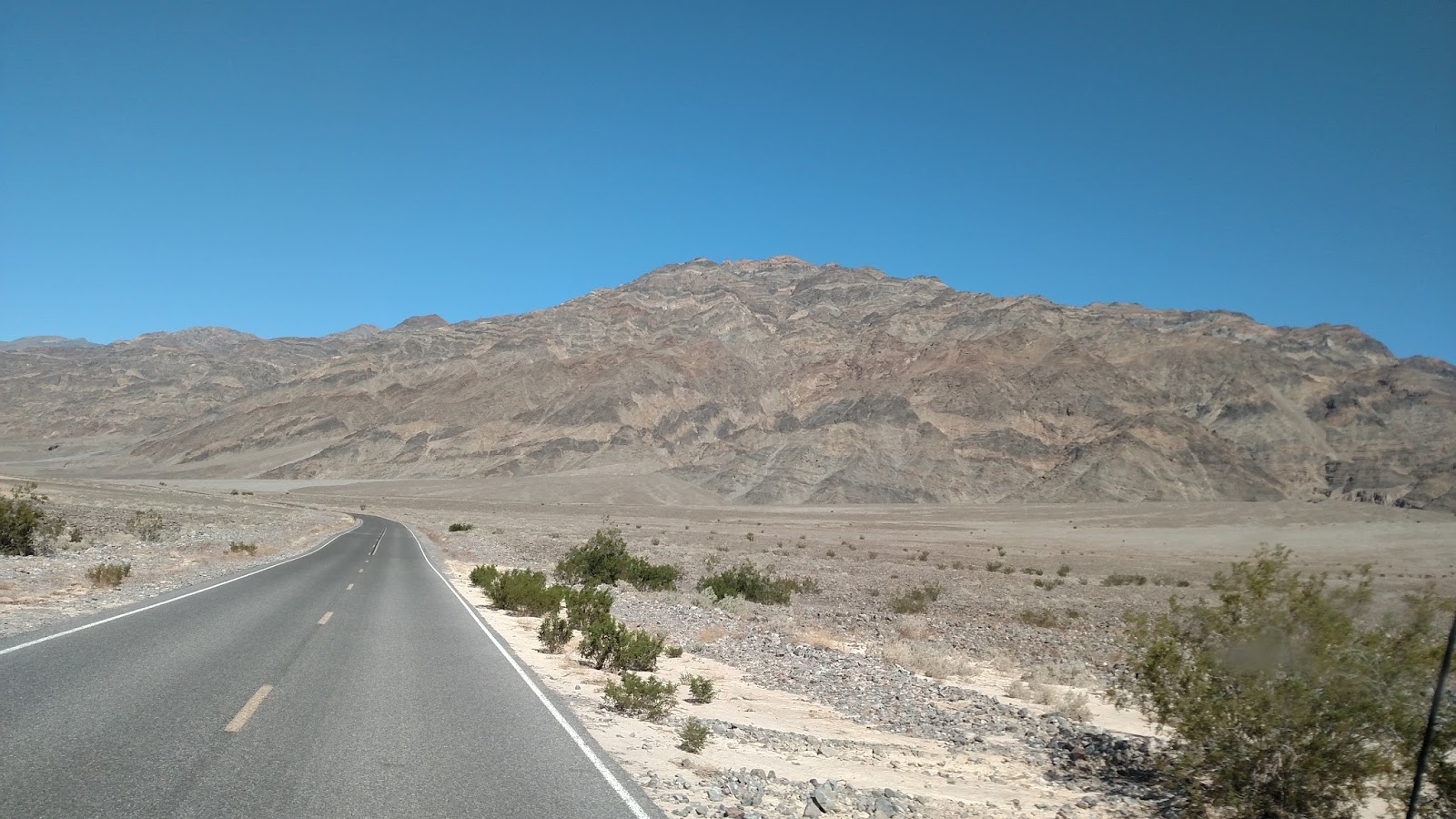
 |
| Nice scenery along the way |
 |
| This was really weird when we first saw this. It looks like a giant light in the desert. At this point we are about 10 miles away from the light |
 |
| We found out that this is a new solar mirror electric power plant called the Crescent Dune Solar Power Plant. The plant has 10,000 computer controlled mirrors that direct the desert sun to that tower in the center that is so bright. It is the first of it's kind to produce electricity 24/7. It heats a salt mixture that stores the heat. |
Death Valley National Park is in California but we stayed in the close by town of Beatty Nevada. Beatty NV is about 8 miles from the entrance to the park but about 15 miles from the actual valley. It’s a great place to use as a base to explore the park because it is located near the middle on the eastern side.
 |
| Entering Beatty NV |


 |
| A large B on the hillside for Beatty. This is done all over the west |
 |
| Our camp base while we are in the Death Valley area. |

The roads in Death Valley are sort of shaped like a large X from north to south. We come into the park from the east to just about where the center of the X is. We are here for just 2 days so we decided to go to the northeast side of the X first. This will take us to Scotty’s Castle and to the crater area. This trip is about 50 miles one way or 100 round trip.
 |
| The long road out of Beatty to Death Valley |

As we entered the park valley the temperature rose about 20 degrees from our base in Beatty. It was 65 in Beatty when we left and it is now 85 on the valley floor. We also dropped about 3,000 feet in 15 miles from Beatty NV to the floor of the Valley! First impression is that this is one very desolate place!
At the cross of the X the road direction sign said that Scotty’s Castle was closed! That sort of sucked, but what can you do, it is what it is!
 |
| The crossroads at the middle on the eastern side of Death Valley |
We went ahead and drove the now 40 miles or so to see the area and the craters. There is a ranger station at the turnoff close to the castle, so we stopped to use the facilities and check out any information that may be available.
 |
| Road going north toward the craters and the turnoff to Casey's Castle |
The ranger station was not occupied but there was information as to why Scotty’s was closed. It seems that there was a one in a 100 years flash flood just last year and it washed out the road to Scotty’s and damaged the castle. There are pictures there to show the repair process. Unfortunately the work won’t be done while we are there.
The craters are a few more miles north. The craters are very cool to see. They are actually blowout craters formed when volcanic pressure in the earth lets loose. These blowouts blew boulders and rocks up to 6 miles away!


On our way back we decided to continue to the lowest part in the Valley. We were going to do that on our second day but since we had extra time due to the castle being closed we decided to go for it today. The lowest point in Death Valley is in a place called the Badwater Basin. It is on the western side of the south part of the X. The southern part of the X is divided again into a Y.
 |
| At the Y intersection is a hotel. A real oasis! |
On our way to the Badwater Basin we stopped at the old 20 mule team borax mine. Borax is literally all around us on the floor of the valley here. All one needed to do was to scrape off the borax layer on the surface and then dump it in a big wooden wagon haul it to an area to refine it a bit and then after you have a few tons haul it out to civilization. Sounds real easy!

 |
| Patty checking out the entire load that a 20 mule team pulled. Note the water tank for the mules and workers on the trail out |
The problem was that they were doing this at the turn of the century with no heavy equipment. Temperatures in the valley reach well over 110 in the summer for weeks at a time. And last but not least, civilization as in Railroad was over a hundred miles away and over the black mountains. So they used these 20 mules hitched up as a team and pulled it out. Suffice it to say the operation didn’t last too long.
 |
| A view of the parking lot from the borax facility. Quite a hike to get here. Can't imagine doing this in the summer when the temperatures are over 110! It was just about 90 when we were here |
We also stopped at a place called Natural Bridge. To get to this place had to travel on a very rough gravel road for about 2 miles. We found out on this trip that the truck actually handles and rides better in 4 wheel drive on roads like this. Not sure why it rides better but it does. Before we had it in 4 wheel drive we could only go about 10 miles an hour. With 4 wheel drive we could do a little over 20 mph. That was a big difference for us.
 |
| The gravel road to Natural Bridge trailhead. It is only rough when you are driving a big truck like we have |
 |
| The trail leading to Natural Bridge |


 |
| And there it is, Natural Bridge. Sort of like Arches National Park |
Badwater is around 100 miles from the Craters, so yes, loads of driving on the adventure! The lowest point in Death Valley is 279 feet below sea level and about 3500 feet below our base in Beatty! Since this was once ocean, the floor of the basin here is mostly a salt and borax mix, so it is white just like a beach.

 |
| Note the little sign on the background mountain. It is where sea level is! |
 |
| You can walk out to the middle of the Badwater Basin. |
 |
| We walked about a quarter of the way. A view back to the parking lot |
On our way back into Beatty from Death Valley we encountered a wild donkey that was standing in the road. I slowed to take a look and to not hit the creature. The donkey just strolled up to the truck and rubbed against the grille. It seemed like he liked the heat from the engine. After he rubbed up against the grille he just moseyed off to the side of the road to let us pass. Maybe he was just lonely!
After our day one adventures of visiting the craters and then the Badwater Basin we headed back to our base in Beatty NV. We had a total travel day of just over 200 miles! We're not in the mood to make dinner so we tried out one of the interesting restaurants in town, KC’s Outpost Eatery and Saloon.
KC’s is a locals type place with a saloon on one side and the restaurant on the other. We walked in through the saloon side and were overtaken by tobacco smoke! It was a good thing that the restaurant was smoke free!

We had great home cooked dinners here and for very reasonable prices.
 |
| Just a picture that says we still need to do domestic chores while we have fun. Laundry Day |
Day 2 of our Death Valley adventure took us again to the southern part of the X but this time to the eastern side of the X. We went to see Dante’s View. This is a viewing area at the end of a 12 mile long single lane road with the last bit being a 15 degree inclining spiral to the top.
 |
| View of Death Valley from the parking lot of Dante's View |
 |
| Patty hiking up to the top of Dante's View |


 |
| Here we are on top of the world, well at least of Death Valley at 6,000 feet from the floor. Actually, we are just halfway to the top, the top is another 5,000 feet! |

Once at the top we hiked up another 600 feet for a total of 6,000 feet above the lowest point in Badwater basin at the bottom. Actually just hiking up this last bit was very awe inspiring let alone the view from the top.
We also stopped at Zabriskie’s point which is on the way to Dante’s View. I can only describe Zabriskie’s point with photos.
 |
| The trail to the top of Zabriskie's Point |
 |
| Patty taking a breather on top |


On our way back into Beatty we saw a heard of donkeys. We stopped this time to take pictures and become friends with them. Well, the friend thing didn't happen but whatever...


Ok, that was it from Death valley.
 |
| The sign leaving Beatty |
 |
| A brothel on the edge of town |

Next up is Las Vegas Nevada.
Stay Tuned!